
The United Nations General Assembly has voted overwhelmingly to support a new approach to world maps that more accurately represents the true size of Africa and other regions that have historically appeared smaller on conventional maps.
The resolution, spearheaded by Togo on behalf of the African Group and supported by the African Union, received 164 votes in favour, while the United States was the only country to vote against it. Six countries, namely Serbia, Estonia, Georgia, Lithuania, Moldova and Ukraine, abstained.
The resolution promotes the use of the Equal Earth projection, a modern world map design created in 2018 that preserves the relative areas of continents more accurately than the centuries-old Mercator projection.
The decision has attracted international attention because it goes beyond cartography. Supporters say the way the world is visually represented can influence how people understand geography, history, power and the relative importance of different regions.
However, the resolution is not legally binding and does not prohibit countries, organizations or technology companies from continuing to use the Mercator projection where it remains appropriate.
Why Is The World Map Being Changed?
For generations, the Mercator projection has been one of the most recognizable ways of displaying the world.
Created by Flemish cartographer Gerardus Mercator in 1569, the projection was designed primarily for navigation. It became extremely useful to sailors because lines representing constant compass bearings could be drawn as straight lines across the map.
The problem is that Mercator does not accurately preserve the relative sizes of continents and countries.
Areas closer to the North and South Poles become increasingly enlarged, while regions around the equator appear smaller in comparison.
That creates some striking visual differences.
For example, Greenland can appear roughly comparable in size to Africa on a conventional Mercator map, even though Africa covers approximately 30.3 million square kilometres and is about 14 times larger than Greenland.
The distortion also affects Europe, North America, South America, South Asia and other regions differently.
Africa’s True Size
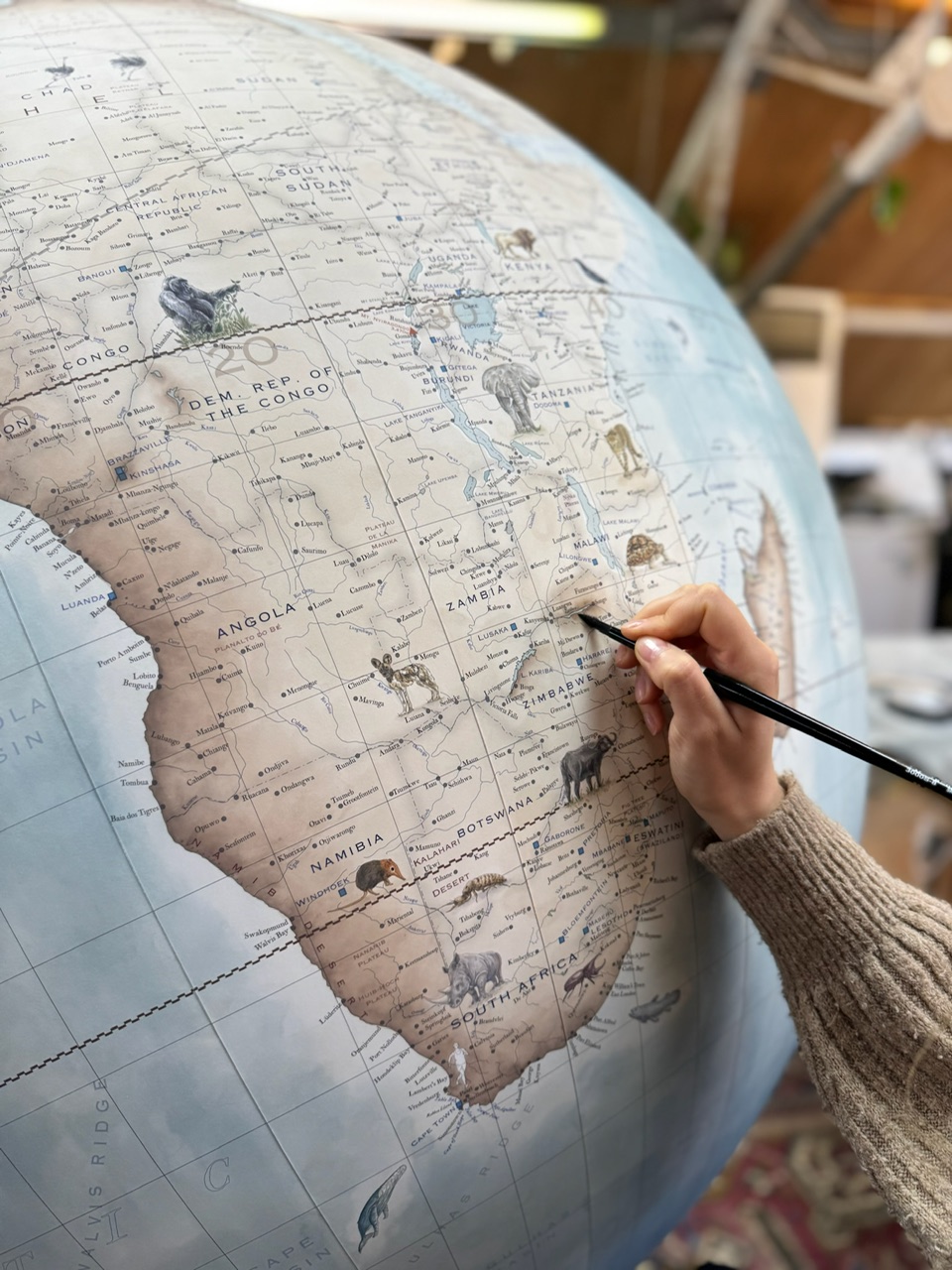
Africa is the world’s second-largest continent by land area, covering roughly 30.3 million square kilometres.
Its enormous geographical size is sometimes difficult to appreciate when looking at a conventional Mercator world map.
Africa is large enough to accommodate the United States, China, India and significant portions of Europe within its landmass.
Yet because of the way the Mercator projection displays the planet, Africa can appear visually much smaller than its actual size when compared with countries and territories at higher latitudes.
The Equal Earth projection changes that visual relationship.
Rather than prioritizing navigation, it focuses on preserving the relative area of landmasses, allowing viewers to get a much better sense of how large continents actually are.
What Is The Equal Earth Projection?
The Equal Earth projection was developed in 2018 by cartographers Tom Patterson, Bojan Šavrič and Bernhard Jenny.
Its main advantage is that it is an equal-area projection, meaning that the relative sizes of regions are preserved more faithfully.
That does not mean the Equal Earth map is perfect.
There is no flat world map capable of accurately preserving every aspect of a spherical planet at the same time. Depending on the projection, a map may prioritize area, shape, distance, direction or another geographical property.
The Equal Earth projection therefore represents a different compromise.
It is particularly useful when the primary question is:
“How big is this place compared with that place?”
That makes it especially relevant for classrooms, textbooks, news graphics and general geographic education.
Togo Leads The Campaign
Togo played a central role in bringing the issue before the United Nations.
The West African country spearheaded the “Correct the Map” campaign on behalf of African countries, arguing that the widespread use of distorted maps has influenced perceptions of Africa for generations.
Togo’s Foreign Minister, Robert Dussey, defended the initiative as a matter of scientific accuracy rather than simply political symbolism.
Supporters argue that if maps influence how people visualize the world from childhood, then improving their accuracy can also improve public understanding of the relative scale of continents.
The African Union endorsed the campaign before the UN vote, giving the initiative broader institutional backing.
How Did Countries Vote?
The final vote produced a striking result.
164 countries voted in favour.
Only one country, the United States, voted against the resolution.
Six countries abstained:
- Serbia
- Estonia
- Georgia
- Lithuania
- Moldova
- Ukraine
The overwhelming vote demonstrated broad international support for encouraging more accurate representations of continental size.
The United States, however, criticized the initiative and argued that the resolution was unnecessary and diverted attention from more pressing international issues.
Why The US Opposed It
The US was the sole country to vote against the resolution.
American officials characterized the initiative as ideological and questioned whether the United Nations should be focusing on map projections.
Supporters of the resolution strongly disagreed, arguing that geography and representation matter because maps are used extensively in education, government, media, technology and public communication.
The disagreement therefore reflects a larger debate over whether correcting geographic representation should be viewed as a technical issue or as part of a broader discussion about historical perceptions of global power.
What Does This Mean For Schools?
One of the biggest potential impacts could be educational.
The UN resolution encourages governments and institutions to consider more accurate map projections for educational materials.
That could eventually mean more students around the world seeing maps where Africa, South America, South Asia and other equatorial regions appear closer to their true relative sizes.
For African students in particular, supporters believe this could challenge geographical misconceptions that have been reinforced through decades of classroom maps.
The objective is not to erase history or pretend that the Mercator projection was useless.
Rather, it is to ensure that students understand why different maps look different and that the familiar map on the classroom wall is not necessarily a perfect representation of Earth’s actual surface.
Could Google Maps And Other Digital Platforms Change?
Another major question is whether the UN decision will influence technology companies and digital mapping platforms.
The resolution encourages broader adoption of more accurate projections, potentially increasing pressure on technology companies, publishers and other organizations to reconsider how they display the world.
However, changing a digital map is considerably more complicated than simply replacing one picture with another.
Different map projections serve different purposes.
Mercator-based projections remain extremely useful for navigation and many web mapping applications because of their mathematical properties.
The UN resolution does not eliminate that use.
Instead, the focus is largely on situations where geographical area and proportional representation matter more than navigation.
Mercator Is Not Simply “Wrong”
One important point has been emphasized by geographers: the Mercator projection should not simply be described as a “wrong map.”
It was designed for a specific purpose.
Its ability to preserve angles and directions made it extremely valuable for maritime navigation.
The problem occurs when people use it as though it were an accurate representation of the relative sizes of continents.
In other words, Mercator is excellent at answering certain geographical questions but poor at answering others.
Equal Earth makes a different trade-off.
It provides a better visual comparison of land area, but it does not preserve every shape, distance and direction perfectly.
This distinction is important because no two-dimensional map can perfectly reproduce a three-dimensional globe.
A Bigger Conversation About Africa
The UN decision has also sparked a wider conversation about how Africa is portrayed internationally.
Supporters of the campaign argue that visual representation matters because Africa has frequently been portrayed through narratives of poverty, conflict and underdevelopment while its enormous geographical, demographic, cultural and economic diversity receives less attention.
The campaign’s advocates say showing Africa at its true scale is one small but meaningful way of challenging inherited perceptions.
Critics, meanwhile, argue that the relationship between a map projection and geopolitical attitudes should not be overstated.
Nevertheless, the debate has succeeded in putting cartography into the international spotlight.
A subject that normally lives quietly inside geography textbooks has suddenly become a global political conversation.
France Also Moves Away From Mercator
France has indicated that it will move away from the traditional Mercator projection for certain purposes.
French Foreign Minister Jean-Noël Barrot said the country would adopt map representations more faithful to actual surface areas and suited to different uses.
France is expected to use the Eckert IV projection, which, like Equal Earth, is designed to provide a more accurate representation of relative land areas.
The development could encourage other governments and institutions to reconsider the maps they use in schools, government publications and public communications.
Why This Matters Beyond Geography
At first glance, changing a world map may seem like a minor issue.
But maps influence how humans visualize the planet.
A child who repeatedly sees Greenland and Africa presented as similarly sized may naturally develop an inaccurate understanding of their actual geographical relationship.
The same applies to the apparent size of Europe, Russia, Canada, South America and other regions.
Supporters of the new approach therefore argue that accurate maps are particularly important in education and public communication.
The debate is ultimately about more than lines, colours and coastlines. It is about the mental picture people carry of the world.
What Happens Next?
The UN resolution is expected to encourage governments, educational institutions, publishers, media organizations and technology companies to consider adopting more accurate equal-area projections.
Togo has indicated that further discussions involving organizations such as UNESCO, the African Union and technology companies are expected as efforts continue to promote implementation.
However, there will not be an overnight disappearance of Mercator maps.
The projection will continue to have legitimate uses, particularly in navigation and certain digital mapping applications.
The more likely outcome is a gradual expansion of alternative projections in classrooms, newsrooms, textbooks and public-facing geographic materials.
Key Takeaways
- The UN General Assembly voted overwhelmingly to support a new approach to world mapping.
- The resolution received 164 votes in favour, one against and six abstentions.
- The United States was the only country to vote against the resolution.
- The initiative was spearheaded by Togo and supported by the African Union.
- The Equal Earth projection is being promoted as a more accurate way to represent continental land areas.
- Africa is approximately 14 times larger than Greenland, despite appearing similar in size on many Mercator maps.
- The resolution is non-binding and does not ban the Mercator projection.
- Mercator remains useful for maritime navigation and other specialized purposes.
- The move could influence maps used in education, media, technology and public communication.
About the Author